The Geometry of Trade
Medieval market towns in Poland were typically founded under Magdeburg Law, a municipal legal framework that prescribed specific spatial arrangements for the commercial core. The central market square — rynek — was laid out as a rectangle, with its proportions varying by town but generally falling between a square and a ratio of approximately 1:1.5. Streets departed from corners and midpoints, connecting the commercial centre to the town's gates and to the surrounding agricultural hinterland.
This regularity was not merely aesthetic. The grid ensured that street widths were consistent and navigable by carts carrying goods. Corner plots, which had the widest visibility from the square, were assigned to merchants dealing in goods that required display — textiles, metalwork, and imported luxury items. Narrower interior plots housed tradespeople whose customers already knew where to find them.
Plot Division and Frontage Control
The initial plot division of the market square perimeter was carried out at the moment of town foundation and recorded in the town's establishment charter. Each plot had a defined width along the square frontage — typically between 7 and 12 metres for standard burgher properties — and extended a fixed depth behind the facade. This depth determined the size of the rear yard and any outbuildings associated with the property.
In practice, plots were divided, combined, and modified over time through inheritance, purchase, and occasional administrative reallocation. Despite these changes, the original frontage pattern often remained stable for centuries, as rebuilding generally followed existing party wall lines. In many Polish old towns, cadastral surveys from the nineteenth century show plot boundaries that closely match those established at the time of the town's medieval foundation.
Stall Placement and Seasonal Arrangements
Within the open square, trading positions were arranged by commodity type. This segregation was both practical — it simplified the collection of market tolls and made it easier for buyers to locate specific goods — and regulatory, reflecting municipal control over which categories of trade were permitted in which locations.
Permanent stalls, constructed in wood or later in masonry, occupied fixed positions within the square. Temporary traders on market days occupied designated areas outside the permanent structures, typically in a zone between the outer ring of permanent stalls and the square's perimeter buildings. The boundary between permanent and temporary trading space was a source of ongoing dispute in many medieval towns, recorded in municipal court documents across the Polish-Lithuanian Commonwealth.
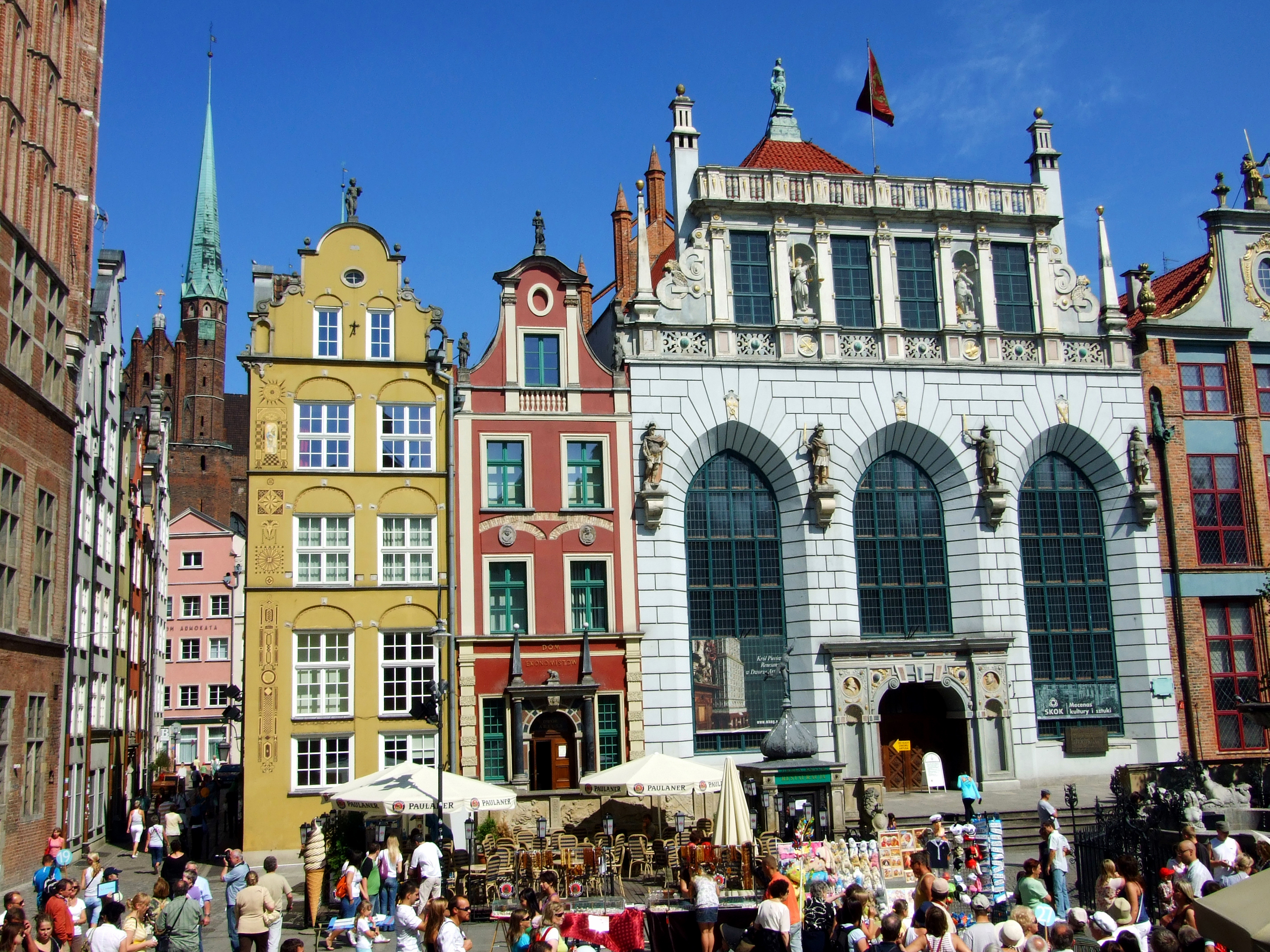
Gdańsk: The Linear Market
Not all Polish medieval markets followed the square plan. Gdańsk's Długi Targ (Long Market) represents a different spatial type: a widened section of the main north-south street connecting the Motlawa waterfront to the upper town. This linear format was typical of port cities where the movement of goods from water to market determined the spatial logic, rather than a grid plan imposed at foundation.
The Długi Targ was enclosed by continuous facades of burgher houses and terminated at its southern end by the Golden Gate and at its northern end by the Green Gate, which served as a residence for Polish kings visiting the city. This axial formality gave the space a ceremonial quality alongside its commercial function — a dual character reflected in the architectural ambition of the surrounding buildings.
Water Access and the Waterfront Market
In riverside and coastal towns, the relationship between the market square and the water was a primary planning consideration. Goods arriving by boat needed direct access routes to the trading area, and the unloading quay often functioned as a secondary market in its own right — particularly for bulk commodities such as grain, salt, and timber that were traded directly from vessels.
In Gdańsk, the crane at the Motlawa waterfront — the Żuraw, rebuilt in the fifteenth century — was the physical link between the river trade and the market. Goods lifted from boats were transferred to wagons and carried the short distance to the Długi Targ. The crane's placement and capacity were therefore integrated considerations in the overall functioning of the market system.

Spatial Continuity and Archaeological Evidence
The persistence of medieval market layouts is visible not only in standing buildings and urban fabric but in archaeological evidence from sites where development has allowed systematic excavation. In Kraków, investigations beneath the Rynek Główny conducted in connection with infrastructure works revealed traces of earlier surface materials, drainage channels, and foundation remains consistent with the known medieval history of the square.
In Wrocław's Rynek, similar investigations have documented successive paving layers and the foundations of structures that occupied the central zone of the square before they were removed in later centuries. This stratigraphic record provides evidence for the changing density of built elements within the open space over time.
References
- National Heritage Board of Poland — nid.pl
- UNESCO World Heritage List — Historic Centre of Kraków
- Wikimedia Commons — Długi Targ photograph (CC BY-SA 4.0)